The CUTD prepared to begin work on the Franklin Street Subway, beginning the process of selecting contractors and undertaking initial tasks such as taking soil core samples. But then an interesting thing happened: some people began to talk of keeping the Loop Elevated. The reasons for doing so were varied, depending on who was advocating it: some felt the CCATP was too expansive and didn't provide enough return on the investment, other felt that the Loop structure was sound and with improvement could continue to serve its original function, and still others felt the Loop was a historic landmark of engineering and Chicago development and should be preserved. Some compared the Loop's cultural impact and association with Chicago to San Francisco and its cable cars, while the Chicago Chapter of the American Institute of Architects compared the engineering significance of the elevated structure to that of the Eiffel Tower.
Since then things have changed and new innovations in repurposing old forms have given rise to interesting ideas. Most relevant is New York's Highline. It's success in repurposing an old elevated freight line in Manhattan to park space has been a huge success for the city. Not surprisingly other cities are wisely looking to emulate New York's success.
In Philadelphia, an old freight and passenger rail line called the Reading Viaduct winds above the streets and between buildings just north of the city’s center. Just like the High Line, the trains stopped running decades ago, and since then nature has taken over the tracks. The self-seeded landscape has inspired some local residents to join together to advocate for the historic structure to be transformed into public open space.
Chicago too has repurposed an elevated freight line, the Bloomingdale Line. One big difference is that the Bloomingdale Line doesn't travel to or through downtown in the same way as the Highline.
All of this background material is to suggest that Chicago should make a large plan. One that will incorporate the city's heritage as well as build upon its existing infrastructure in a way that will maximize the city's potential. I know that the financial hurdles will probably keep this vision from ever becoming a reality. But if downtown continues to grow the city should think about build a Wells St. subway line, eventually building a Lake St. subway line, and turning all that empty trackage into a park.

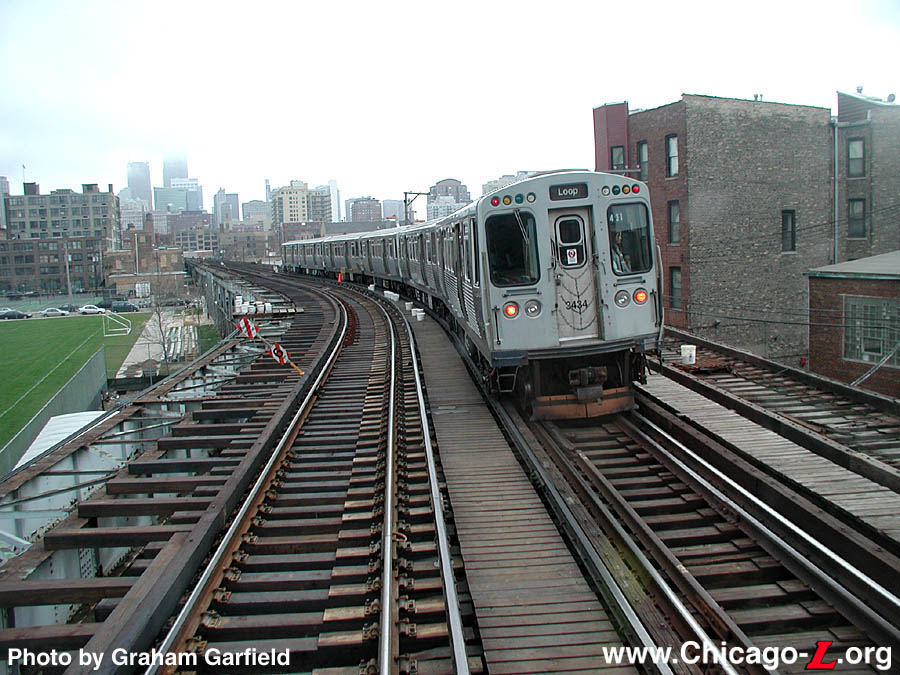
The current configuration of the Brown Line diverges from the Red Line at Fullerton. The Red Line descends, reaching its next stop at North and Clybourn underground. The Brown Line continues above ground in a route that twists and turns slowly. If you were heading to someplace inside the Loop, like Clark and Randolph, it is faster to take the Red Line at Fullerton rather than the Brown Line. They make the same number of stops but the Red Line travels faster. Indeed I know many commuters who transfer from the Brown Line at Fullerton and do just that.
But by building a subway line the follows approximately the Brown Line's path underneath Wells St. the trip would go much faster. Indeed putting a subway line underneath Wells or Franklin has long been an idea planners dreamed up for Chicago.
This plan is much more attractive, however, if it is coupled with repurposing the elevated trackage into a park.

One possible reconfiguration. At North and Clybourn the Red and Brown Lines diverge. The Brown Line will head south for the Loop. The Red Line will head east and then turn south and meet its old route at Clark and Division. From there the Red Line traces its old route through the Loop. The portion of Division running east-west could be used as a connecting service line, or the preliminary trackage of a long sought east west subway line on the Northside.
Alternatively, the Red Line could continue exactly as is and the Brown Line subway would cross at Division and Clybourn, and again reuniting at North and Clybourn, basically following more or less the current path but underground.
Finally, the Red Line will exit the subway from the old eastern subway portal on 14th between State and Wabash where it will take its former route on the Green Line tracks south. The Brown Line will follow underneath Wells through the Loop. New station configuration wouldn't necessarily be at exactly the same intersections as before. A new stop would be added where there is none in the South Loop. Possibly on Polk and Wells. From there the Brown Line will exit where the Red Line currently makes its exit from the western portal. From there it will follow the Dan Ryan tracks south.
Just building the Wells St. line could replace about 3.5 miles of elevated trackage, reduce transit times, and create about 3.5 miles of beautiful parkland on historic train lines. The neighborhood is already a dense, transit oriented community with plenty of places ready for more infill.
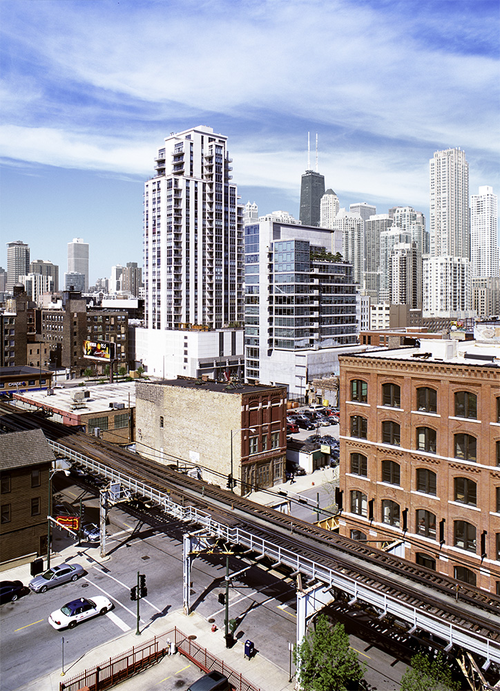
This trackage would become park space. As you can see there is a mix of old, dense building and open lots that are ripe for infill.
From there it would really only take building a few miles of subway line to supplement the Blue Line tracks all the elevated lines could be recirculated into a subway through the Loop. The Green Line would descend, probably around the Kennedy Expressway, and meet with the Blue Line tracks. Ideally the city would follow through on long aspirated and recently proposed Clinton St. subway, forming a perfect circuit. But even without that it would be possible to reroute all the elevated lines through the Loop with only the Lake St. subway tracks. From the Northside the Red and Brown lines are already covered. From the Southside the Green Line would descend through the Red Line's portal and become the new Red Line. The Orange Line would follow the Brown Line and, through a short Lake St. route emerge on the Westside and become the new Lake St. Green Line. The Pink Line could follow a number of possible routes as well.
Initially it would take building about 3.5 miles of Brown Line north of the river followed by 1 mile of new Lake Street subway, and 2 miles of subway inside the Loop to make this come to fruition. Ultimately around 7 miles of subway altogether. This would generate around 5.5 miles of park space in downtown Chicago, giving citizens and tourists alike a fabulous bird's eye vista of the city.
Again, the enormous costs of such a project makes it unlikely that it will ever be attempted, which is a shame. If the city's population and transit usage continues to grow, laying the foundation for a 21st century transit plan is more important than ever. The original State and Dearborn subway lines, totaling 7.7 miles, was estimated at 46 million dollars. In today's dollars that is roughly 7 billion 350 million dollars. Theoretically innovations in labor productivity should make building another 7 miles of subway should be much lower. Perhaps one day an innovative labor saving device to tunnel through the earth will make such a plan feasible. Until then Chicago residents will have to merely dream of an improved transit network and a magnificent Loop park.
Imagine this similar to this

Make no small plans
Your post really helped me to understand the . It has great details and yet it is easy to understand.That's what i was looking for. I will definitely share it with others.
ReplyDeleteianjohnson